Why did Welling High Street stop being the road to Dover?
Because in 1928 somebody built a new road a mile to the south — halfway through the fifteen years in which Welling was being built. The one-hour parking limit outside the shops is the last visible consequence.
Every quote we write here arrives at the same sentence: you can stop on Welling High Street for an hour. Not two, not while everybody finds their coats. One hour, between 8am and 7pm, six days a week. That is not a council being awkward. It is the last visible consequence of a decision taken in 1928, in a town built the wrong way round.
A road first, a town second
Welling exists because of Watling Street. The Roman road from Dover to London ran along the line the A207 still follows, and the University of Greenwich’s history of the suburb is blunt about cause and effect: the growth of the area “was tied up with Watling Street, the Roman road from London to Dover, and the trade that could be had from the travellers who used it”. Welling was not somewhere people went. It was somewhere they went through, and stopped at because it was there.
The name comes from the same era, though not the way it usually gets told. You will hear that Welling was a watering place for horses on the Dover Road; we went looking for a source and could not find one. What the sources say is quieter. The settlement appears as Wellyngs in a document dated 1362, and the likeliest origin is the Old English wella, a well or a spring — there was an underground spring at Welling Corner, where the gun stands today. The other candidate is a family, the Willings, recorded here in 1301. John Ogilby’s road atlas of 1675 has the place as Wellen. And the folk story that did survive locally is better anyway: Shooters Hill was thick with highwaymen, and to reach Welling intact was a well end to the journey.
Then the railway, and the town filled in
The Bexleyheath Line opened on 1 May 1895 and Welling got a station. That changed what the place was for. After the First World War, Bexley Urban District Council borrowed £400,000 and built 426 houses north of the railway — the Welling Council Housing Scheme. Then the Danson estate was broken up: the council bought the park itself in 1924 for £16,000 and opened it to the public in 1925, and the land to the south went to developers. Through the 1930s New Ideal Homesteads Ltd built the Falconwood Estate and a local builder named Stevens put up another large one.
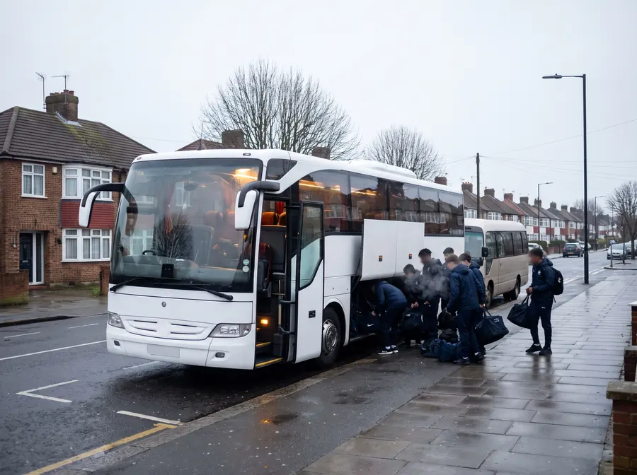
In roughly forty years a village on a road became a suburb of semi-detached pairs and short terraces, with narrow frontages, no garages worth the name, and both kerbs permanently parked. That is the street in the photograph below, and it is the entire reason a 12-metre coach is the wrong tool for most jobs in DA16.
1928: the road left
Here is the pivot, and it lands in the middle of the building boom. While the houses went up, a new alignment of the A2 was being driven south of the town. Rochester Way carried the trunk road past the climb over Shooters Hill; before it had even opened, work had started on a branch off it. That branch, East Rochester Way, opened in 1928, extending the arterial road past Bexleyheath and Dartford and taking the A2 clear of Welling High Street altogether. The standard account of the A207 records the outcome in one dry clause: the road through Welling is the former A2, before it was bypassed to the south. The Relief Road finished the London end of the same job in 1988.
So the sequence runs: a Roman road; a village on it; a railway in 1895; forty years of house-building; and then, halfway through, the road itself walked away. Welling was left with a wide, straight high street that no longer had anywhere in particular to go.
Which is exactly why the parking is what it is
A high street that is still an A-road but is no longer a trunk route ends up as a shopping parade belonging to the borough. Bexley runs the pay-and-display bays on the A207 through Welling itself, which it could not do on a Transport for London red route, and sets a one-hour maximum outside the shops.
The council also keeps two car parks in Welling, and their two personalities tell the whole story in miniature. Westwood Lane: 125 bays behind a 2.1 m barrier — built for the cars of a 1930s suburb, and it bars every vehicle we own. Nags Head Lane: 73 bays, no height limit, a separate RingGo code for lorries, and written permission for coaches and HGVs to stand overnight from 5.30pm to 8.30am. Only two car parks in the entire London Borough of Bexley carry that permission, and one of them is 200 metres from Welling High Street.
A stretch of Roman road, a Victorian railway, a 1920s housing loan and a 1928 bypass, all still deciding where we can put a minibus on a Tuesday morning. None of it is in the brochure, and all of it is in the quote.
Which is why, when somebody rings and says “we need a coach in Welling”, the first question back is not how many of you there are. It is: which end of the High Street?
Sources for this piece, all read on 29 August 2026: ideal-homes.gre.ac.uk (University of Greenwich, Ideal Homes: A History of South-East London Suburbs) for the Watling Street trade, the 1362 first mention, the £400,000 loan and the 426 houses; en.wikipedia.org/wiki/Welling for the 1895 line, the Willing family, Ogilby’s 1675 atlas and the 1965 transfer to Greater London; roads.org.uk for East Rochester Way in 1928 and the Relief Road in 1988; en.wikipedia.org/wiki/A207_road for the former-A2 alignment; bexley.gov.uk for both car parks and every parking figure.